
Disclaimer:
The authors are solely responsible for the content of this report. Material included herein does not represent the opinion of the European Community, and the European Community is not responsible for any use that might be made of it.
Back to overview reports
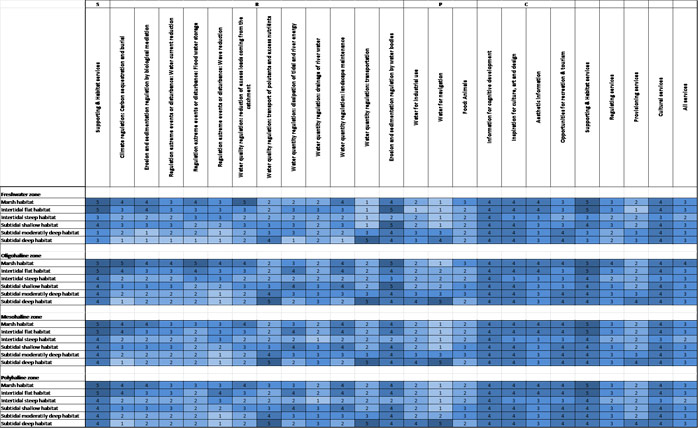
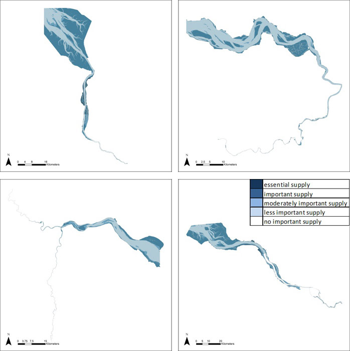
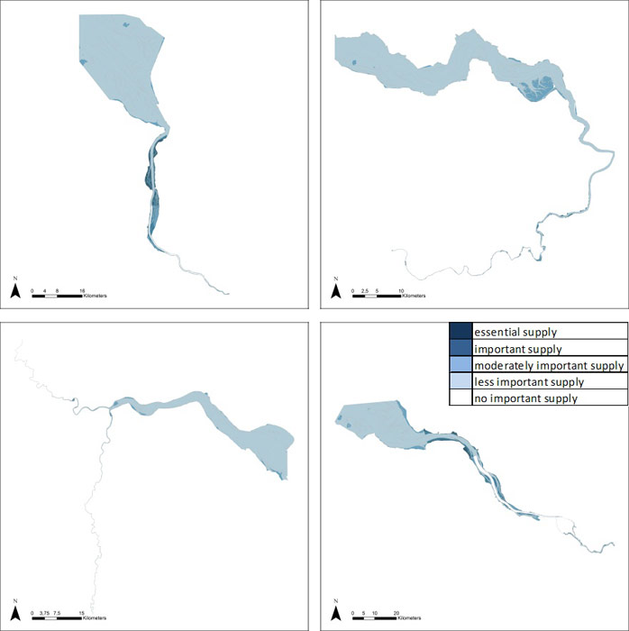
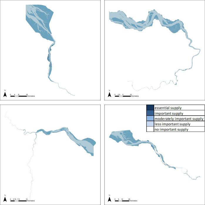
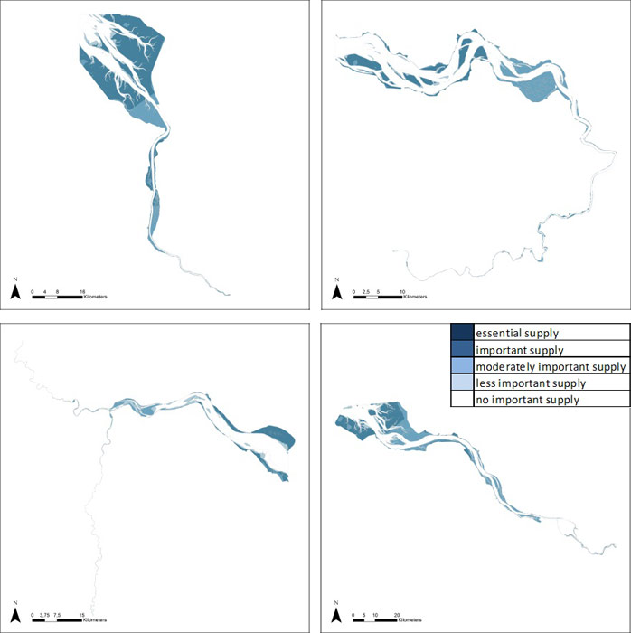
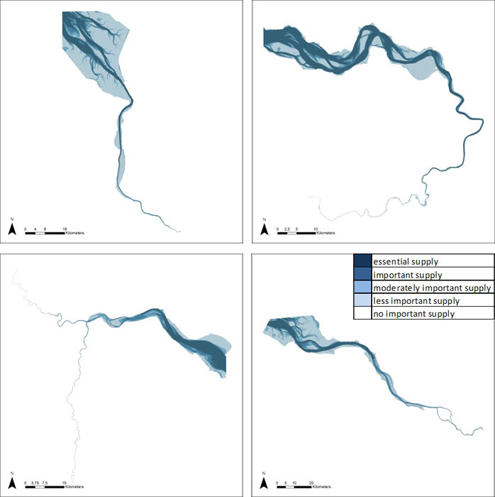
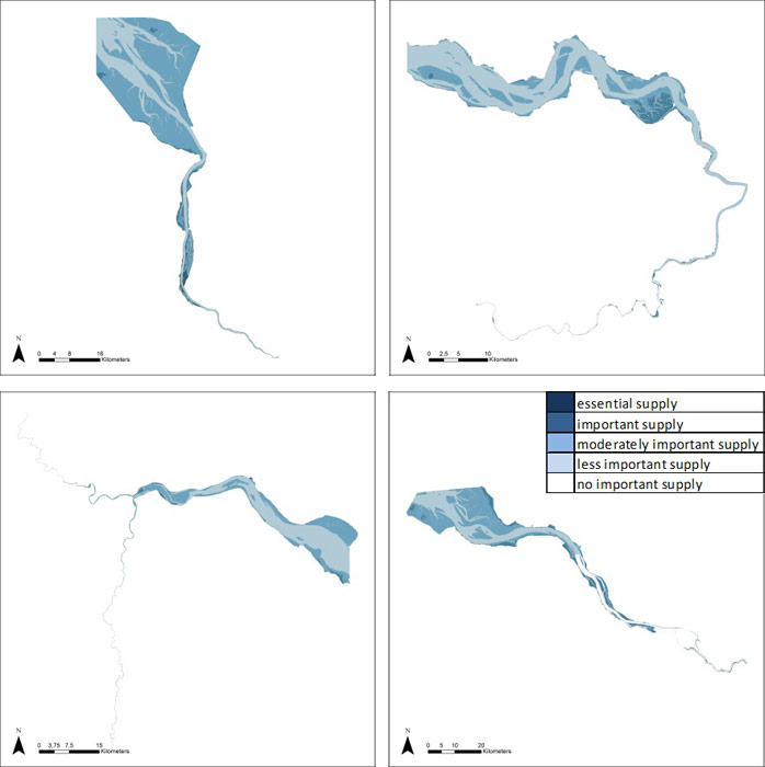
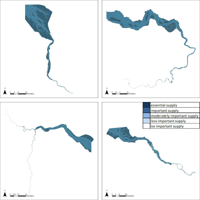
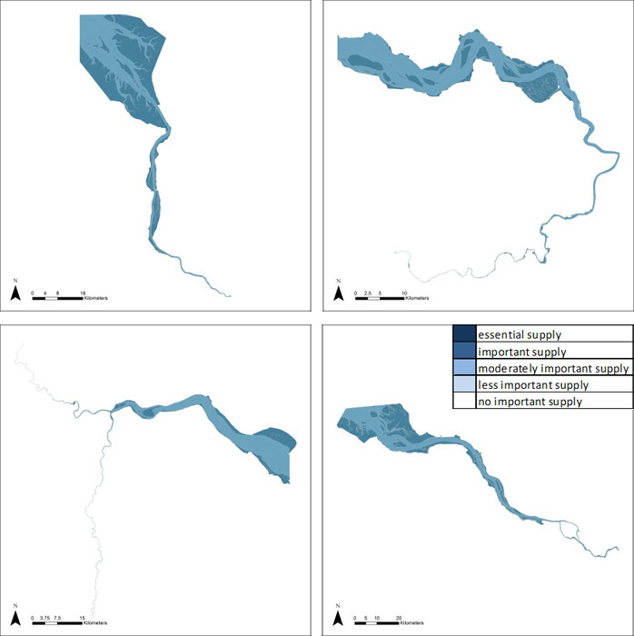
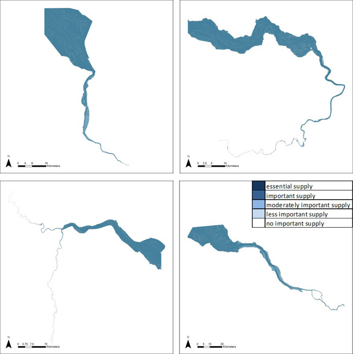
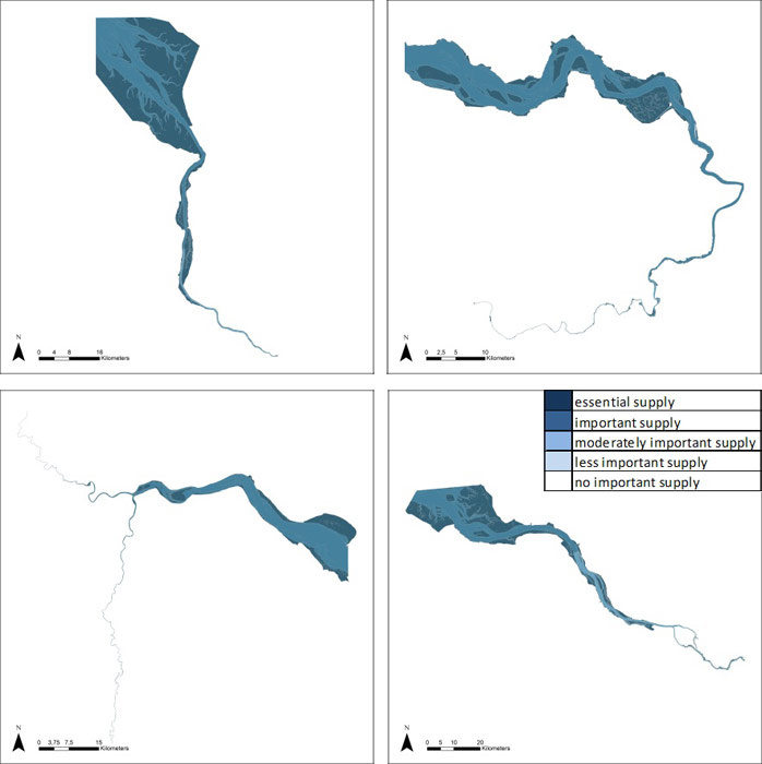
Since there is a high consistency among estuaries’ supply scores, one single average estuary score matrix was constructed. This score matrix incorporates all expert scores. As such, maps can be compared to assess distribution of ES along the longitudinal gradient of the estuaries. The TIDE ES maps provide an inventory of ecosystem services in four industrialized estuaries, based on habitat-specific supply scores per salinity zone, and involving local and site-specific scientific expertise. Inter-estuarine variation in scores is assessed in section 5.5.
Salinity zones were defined in four zones: freshwater zone, oligohaline, mesohaline and polyhaline zone. This allowed to obtain a similar, comparable zonation over all four TIDE estuaries. However, this also reduced the detail of estuaries with more elaborate zonation (eg the Elbe contains three freshwater zones and the Scheldt ten zones), which were averaged within the four comparable zones. In some single cases the merge of the freshwater zones can lead to results which differ from the result obtained by the expert group; this will be indicated at the particular cases.
In the following section, maps per ecosystem service are provided, together with short explanations and description of some of the basic structures and processes involved. Each of these factsheets provides an overview of supply of the ecosystem service throughout the TIDE estuaries. Applied and relevant ecological research for estuarine management should focus on further description and centralization of ecological functions and mechanistic understanding per service, including available parameter and modeling data, as well as assessment of uncertainty and data needs.
Substantial food provision in estuaries is mainly regarded as historical. Livestock grazing and fodder production on the highly fertile marshes was a common practice, with crops in the freshwater zones and extensive grazing in brackish and salt marshes. Also, direct fishing and shellfish breeding inside estuaries occurred more commonly in history. The higher scores for marshes in the freshwater and oligohaline zone reflect this supply. Although agricultural practices abide in some areas, they have disappeared in many others due to excessive pollution and market shifts. However, estuaries are still regarded highly important as foraging, breeding or spawning ground for commercial fish species which spend part of their live cycle in fresh or brackish water. This is reflected in the higher scores of shallow and moderately deep subtidal areas.
Structures & processes
Food provision is strongly driven by ecological habitat quality and biodiversity. Shallow areas with low hydrological stress (currents, waves, erosion), opportunities for shelter and high benthic productivity are essential, as well as the presence of a full gradient in habitats which are well connected. This service has its main feedback to the supporting / habitat services, positively (increased biodiversity) as well as potentially negatively (e.g. overfishing, habitat modification for increased shellfish productivity).
Quantification and pricing (Liekens et al 2013B) can be performed by estimating the market prices for animals and crops grown in estuarine ecosystems. It is to be noted that, in general, the current benefits (monetary benefits in particular) obtained from biodiversity resources do not often reflect sustainable extraction or production patterns. The external costs related to this issue are not taken into account. The estimated value of the biodiversity resource based on market price is equal to the quantity of sold resource x (market price – costs related to production). Liekens et al (2013B) suggest taking the standard gross margin as indicator.
Requirements for industrial use water are not as stringent as for provision of e.g. drinking water, although some industries require fresh water. However, often large amounts are needed in relatively short timespans, which requires the presence of adequate volumes at all times. Deep subtidal habitats are therefore important, and since most industrial activities are often concentrated towards the mouth of estuaries, these deep habitats get a higher score in poly- and mesohaline zones. Using the score matrix does reveal habitat-driven differences, but some specific estuarine supply aspects are lost. For instance, in the Elbe, this service was scored higher in freshwater and oligohaline zones, where most industrial activities are located. These inter-estuarine differences are represented in detail section 5.5.
Structures and processes
This service is mainly physically driven. Main driving factors are the presence of deep water habitat (adequate volumes) as well as the quantities provided by discharge and tidal influx. However, the use of this service impacts on supporting / habitat services since returning of cooling water (often with increased temperatures and algicides) could impact the ecosystem locally: increased productivity or changes in algal community composition, or local microclimate conditions altering composition of higher trophic levels. An important process is the residence time and the volume of the water in the zone where the cooling water is released. This determines the concentration or heating impact.
As an indicator, the volume (m³) water directly taken from the estuary for processing and cooling by industrial sector in the estuary can be used, while the costs of losing or replacing natural water supply or finding an alternative for it can be used as an estimate for its value (Liekens et al 2013B). In addition, opportunity costs, i.e. loss of income foregone due to the loss of water supply, can also be used as an indication for the value.
Requirements for navigation use water are straightforward. Water bodies require adequate depths and width, while complex and dynamic morphology as well as sedimentation of these habitats might increase costs for shipping. Scores are highest for deep and moderately deep subtidal habitats, while shallow areas are less important (mainly recreational navigation). Using the score matrix reveal habitat-driven differences, but some specific estuarine supply aspects are lost. For instance, in the Elbe, this service was scored lower in the freshwater zone upstream of the harbour, compared to the other estuaries. These inter-estuarine differences are represented in detail section 5.5. Also, the estuary-specific zonation scores were averaged in the four common zones. In this case it has to be noticed that for instance in the Elbe, the freshwater zone 1 upstream of the harbour (see report “Zonation of the TIDE estuaries”) has a lower score as the zones 2 and 3 downstream the harbour.
Structures and processes
This service is mainly physically driven. Main driving factors are the presence of deep water habitat (adequate volumes) as well as the quantities provided by discharge and tidal influx. However, the use of water for navigation has an impact on supporting / habitat services since dredging and disposal of sediments (often causing increased turbidities or availability of pollutants) could impact the ecosystem locally: direct impacts on benthic communities, decreased light availability and primary productivity or changes in algal community composition, or local conditions altering composition of higher trophic levels. This engenders an impact on all services depending on supporting and habitat services (see section 5.4).
The value of water for navigation is estimated by the prevented costs made by ships not being able to make use of the full loading capacity functions. It is assumed that the costs exist out of more trips to the deliver address or by transport the rest load by another mode: train or truck (Liekens et al 2013B).
As carbon sequestration and burial is linked to biological productivity and sedimentation/burial of sediments; marshes and intertidal areas have the highest scores. Other habitats can also store carbon if they silt up. Inter-estuarine differences among zones and habitats are represented in detail section 5.5.
Structures and processes
Carbon sequestration and burial has both biological and hydrological drivers. Uptake of carbon in the estuarine food web (linked to productivity of algae and vegetation) and long-term sedimentation into deeper soil layers are the main drivers. The fate of this carbon is long term burial or sequestration and potential uptake. This decides whether carbon is removed from the atmosphere on the long term.
Carbon sequestration and burial is only one of the estuarine functions related to climate regulation. It can be regarded as an intermediate service delivering the final service of climate regulation. Other intermediate services include direct cooling effect of water bodies, cooling effects of vegetation, processes related to production of methane and other greenhouse gasses etc. These are all related and should be addressed together.
In Liekens et al (2013B), an extensive literature review on this topic can be found. Here, some basic processes are described: Estuarine ecosystems are extremely productive biologically (Bianchi, 2007), with net primary production rates among the highest of the world. Consequently, these systems play globally an important role as carbon sinks (Chmura et al., 2003).
Sediment carbon is oxidized by microbial mediation to other species, including, among others, carbon dioxide (CO2), methane (CH4) and nitrous oxide (N2O). Production of these gases is potentially important since they are greenhouse gases (GHGs), all with a different Global Warming Potential. GWPs are measures of the contribution towards global warming and integrate a gas’ radiative absorption ability, its atmospheric residence time, the frequency of radiation which it absorbs and any indirect effects by feedbacks (Forster et al., 2007). Over a 100 year frame the GWPs of CO2, CH4 and N2O are 1, 25 and 298 respectively (Forster et al., 2007); meaning that 1 tonne of N2O would affect global warming as much as 198 tonnes of CO2. These GWPs are in fact carbon dioxide equivalents (CO2eq). Applying these GWPs to the GHG flux data, and converting the C burial into CO2 equivalents allows this data to be directly compared, permitting the calculation of net CO2eq-fluxes.
Carbon is sequestered when the net effect of all CO2eq-fluxes is negative; this occurs when more carbon enters a system, than the amount of carbon that will leave the system.
C sequestration = C-burial + (CO2+CH4+N2Ofluxes) (+ long lasting biomass)
Short-term carbon sequestration occurs in biomass, long-term carbon storage would be based on carbon removed over app 100 years (Crooks et al., 2010) and therefore only sequestration in sediments is taken into account.
Long lasting biomass might be an important long-term carbon pool too, especially when it concerns trees (mangroves,…). Hereto also belowground biomass has to be accounted for. Furthermore, due to sea level rise, sedimentation is an ongoing process and so is the sequestering capacity.
Flood water storage is beneficial as the water volume which causes flooding of properties is stored in areas where the damage is lower or zero. This is reflected in the highest scores for marsh habitat in upstream zones. Large differences between estuaries occur, as marsh habitats are much more abundant (relatively) in the Weser (and to a lesser extent in the Elbe), while in the Humber and Scheldt, these are very small in surface. In the poly- en mesohaline zone subtidal habitats play a role as determining factor for the amount of water coming into the estuarine funnel, and direct storage above marshes is moderately important (except for the large ‘Land van Saeftinghe’ area in the mesohaline zone of the Scheldt). Inter-estuarine differences among zones and habitats are represented in detail section 5.5.
Structures and processes
This service is entirely physically driven. The shape and volume of the estuary in the poly- and mesohaline zone determines the volume and speed of the tidal wave, while the extent of intertidal and mainly marsh habitat (which is close to critical elevation for flooding) determines the amount of flood water potentially stored. Complex interactions with water quantity-influenced services exist, as the tidal propagation influences sedimentation-erosion balances. However, there are also potential synergies with habitat and supporting services, as marshes or flooding areas can be essential biodiversity hotspots.
Concerning quantification, Liekens et al (2013B) note that services related to disturbance prevention or moderation reduce flood risk. The benefits of flood alleviation comprise the flood damage averted in the future as a result of schemes to reduce the frequency of flooding or reduce the impact of that flooding on the property and economic activity affected, or a combination of both. This is reflected in less material and immaterial damages. It is not possible to translate the assessment methods into easily applicable indicators that can be applied in different estuaries. However, the principles of this method are accepted internationally. Liekens et al (2013B) refer to FHRC 2010 the benefits of flood and Coastal Risk management: a handbook of assessment techniques 2010 for a stepwise approach to assess the benefits of flood prevention.
Intertidal habitats and shallow zones are scored as more important for reducing water currents than other habitat types. Water current reduction takes place at different levels: morphological structures reduce water current in subtidal (except in the freshwater area, where this is less important) as well as intertidal habitats. Reduction of this current decreases shear stress and incoming tidal volumes. On intertidal habitats, and especially on marshes, organism structures (vegetation) are also known to strongly reduce water current. This reduces erosion of protective natural or technical infrastructures. Inter-estuarine differences among zones and habitats are represented in detail section 5.5.
Structures and processes
Reduction of water current as an ecosystem service, is physically driven, but on marshes, biological structures also exert this physical role. Apart from direct damage to infrastructures, excessive water currents also cause potential excessive erosion in the estuarine system, disturbed benthic population dynamics, high turbidity and hence impacts on primary production of the algal community. It interacts with all ecosystem services linked to water quantity.
Intertidal areas and shallow zones get the higher scores. Reduction of waves decreases erosion of marsh edges and protective infrastructure. Inter-estuarine differences among zones and habitats are represented in detail section 5.5.
Structures and processes
Wave reduction is a service which is physically driven, but on marshes, biological structures also exert this physical role. Wave reduction is a physical process. Waves, generated by wind or ships, are attenuated by physical structures or organisms, mainly vegetation. Apart from direct damage to infrastructures, excessive waves cause potential excessive erosion in the estuarine system, which consequences as disturbed benthic population dynamics, high turbidity and hence impacts on primary production of the algal community. It interacts with all ecosystem services linked to water quantity.
Drainage of river water is a basic but essential process of evacuating water from the catchment, which guarantees basic activities performed in the estuarine valley. Especially, evacuation of the river water after a storm tide is very important as storm tides are often coinciding with heavy rainfall (and potential high discharges from the catchment), and emptying the estuary is essential to prevent flooding by consequent surges. It is provided by the deep subtidal habitat mainly, but also other habitats play their role as temporary discharge buffers. Inter-estuarine differences among zones and habitats are represented in detail section 5.5.
Structures and processes
Drainage of river water is physically driven. It consists of the connection of the catchment with the estuary, the buffering potential of discharge in intertidal areas, and the evacuation of water out of the estuary in between tides. It interacts with all ecosystem services linked to water quantity. Optimal drainage requires an open and free flow, but on the other hand this might increase the tidal volume coming in (see section 5.3.5, 5.3.6). Tidal amplitude and tidal asymmetry and its links with morphology are essential drivers.
This service is very similar to flood protection, but while flood protection is linked to extreme events and storm flood volumes (highest intertidal habitats), dissipation is the regulating process for everyday tidal volumes. Too high river or tidal energies exert continuous hydrological stress on habitat & supporting services and on infrastructures, mainly through excessive water currents and erosion. Dissipation occurs in shallow areas and intertidal areas. Inter-estuarine differences among zones and habitats are represented in detail section 5.5.
Structures and processes
This ecosystem service is almost entirely physically driven. The shape and volume of the estuary in the poly- and mesohaline zone determines the volume and speed of the tidal wave, while the extent of intertidal habitats determine the amount of energy potentially dissipated. Complex interactions with water quantity-influenced services exist, as the tidal propagation influences sedimentation-erosion balances. However, there are also potential synergies with habitat and supporting services, as intertidal areas can be essential biodiversity hotspots.
This service describes the ensemble of natural processes which ensure an equilibrium in sedimentation (= formation of new habitats) and erosion (= decrease in older habitats). Essential are sedimentation areas in shallow water and intertidal flats, which allow emergence of new habitats at young succession stages, which are often lacking from highly dynamic zones. However, the erosion of tidal marshes is an evenly important process. Overall, this service can be regarded as an intermediate service to many final services. Its delivery could be evaluated by assessing the long-term trends in habitats ratio’s and equilibria between marsh formation and erosion. Inter-estuarine differences among zones and habitats are represented in detail section 5.5.
Structures and processes
This service is driven by sedimentation erosion processes and thus mediated by morphological as well as biological processes and structures. Morphology and water quantity related services are strongly interacting, but the presence of complete gradients and specific habitats is essential for the biological and morphological functioning of the estuary. These processes generally play a role in any habitat, but most importantly in the shallow water and intertidal habitats.
Requirements for navigation use water are straightforward. Water bodies require adequate depths and width. This is an intermediate service for the final provision of water for navigation (section 5.3.3). The complex and dynamic morphology is regulated by water quantity and morphology aspects, which can cause erosion as well as sedimentation of the fairway, which might increase (dredging) costs for shipping. Scores are highest for deep and moderately deep subtidal habitats where these processes impact directly on accessibility, while shallow areas are important as sedimentation areas. Inter-estuarine differences among zones and habitats are represented in detail section 5.5. Notice, that the estuary-specific zonation scores were averaged in the four common zones. In this case notice that for instance in the Elbe, the freshwater zone 1 upstream of the harbour “Zonation of the TIDE estuaries”) has a lower score as the zones 2 and 3 (see report downstream the harbour.
Structures and processes
This ecosystem service is mainly physically driven. Main driving factors are the water quantities provided by discharge and tidal influx and the morphology of the fare way. The service is interacting with supporting & habitat services by direct impacts on benthic communities, light availability and productivity or changes in algal community composition, or local conditions altering composition of higher trophic levels.
This service describes the basic physical removal of pollutants and excess nutrients out of the system by dissolution in the estuaries water mass and transport towards the sea. The scores are very similar to e.g. drainage of river water with a decreasing importance of habitats higher in the tidal frame. Inter-estuarine differences among zones and habitats are represented in detail section 5.5.
Structures and processes
This service is mainly physically driven. Main driving factors are the water quantities provided by discharge and tidal influx and the morphology of the river. The service is heavily interacting with supporting & habitat services, since excessive loads of nutrients or pollutants will impact benthic communities, algal community composition, or higher trophic levels, and overall functioning of the estuarine ecosystem.
This service describes the filter function of the estuary by uptake of nutrients and pollutants in the ecosystem (biologically by uptake of organisms, of physically by sedimentation and chemical absorption and immobilization). Highest scores are found on areas where high biological activity coincides with high sedimentation rates. Marshes are particularly important. However, also in the pelagic food web, nutrients are being sequestered. Inter-estuarine differences among zones and habitats are represented in detail section 5.5.
Structures and processes
This service is mainly biologically driven. Main driving factors are the productivity of algal communities and the biologically active layer on subtidal and intertidal sediments. However, hydrology plays an essential role as it determines retention times, flooding frequencies and duration, and evenly important are sediment features and morphology which determine pelagic light climate, intertidal soil porosity and reactivity etc. The service is heavily interacting with supporting & habitat services, since excessive loads of nutrients or pollutants will impact benthic communities, algal community composition, or higher trophic levels, and overall functioning of the estuarine ecosystem.
In Liekens et al (2013B) the importance and complexity of identifying, quantifying and valuing this service is illustrated (see also 5.2.)
This service is the purely physical regulation of erosion and sedimentation processes occurring in estuaries. All habitats are important, since deep subtidal as well as shallow subtidal and intertidal habitats play essential roles in regulation of sedimentation and erosion. Marshes and tidal flats however are scored highest, as they tend to accumulate sediments, avoiding sedimentation in deep subtidal and providing natural habitat formation. Inter-estuarine differences among zones and habitats are represented in detail section 5.5.
Structures and processes
This service is mainly physically driven. Main driving factors are the position of the habitat in the tidal frame, and the local dynamics and water currents. Processes and structures are linked to the service of landscape maintenance (5.3.10).
This is the biological component of regulation of erosion and sedimentation processes occurring in estuaries. All habitats are important, since biota in deep subtidal (benthic organisms) as well as in shallow subtidal and intertidal habitats play potential roles in regulation of sedimentation and erosion. Marshes and tidal flats however are scored highest, as vegetation plays a major role as ecological engineer by preventing erosion, determining sedimentation-erosion patterns and driving changes in marsh morphology and tidal flat elevation. Inter-estuarine differences among zones and habitats are represented in detail section 5.5.
Structures and processes
This service is mainly biologically driven, and together with its physical counterpart (5.3.14), these can be regarded as intermediate services for landscape maintenance (5.3.10). These services determine abundance of different structures and gradients and services emerging from them. Main driving factors are the ecological quality of the habitat, the presence and viability of populations of key species, the habitat connectivity and colonization dynamics. Important processes include water current reduction and sediment capturing (in subtidal shallow and intertidal vegetation), bioturbation (e.g. by benthic macrofauna) and increasing resistance against erosion (e.g. benthic algal layers).
Biodiversity, broadly defined, contains all processes directly or more indirectly involved in sound ecosystem functioning. Hence the importance of all habitats. Resilience of the ecosystem increases with biodiversity. Resilience of a system is the capacity to recover from impacts, anthropogenic as well as natural. In estuarine ecosystems, this resilience is of key importance since stress (long term) and disturbance (events) are inherently part of the estuarine ecotope. In terms of ecosystem services, resilience can be defined as “the ability to provide regulating services under varying circumstances”. As estuarine ecosystems are intensively used, and impacts of this use on basic processes are significant, determining the risk of losing this resilience is essential.
Therefore, profound and integrated understanding of the estuarine system and the appearance of thresholds, regime shifts and tipping points is needed, as well as quantification of scientific uncertainties in order to adequately address the precautionary principle. Inter-estuarine differences among zones and habitats are represented in detail section 5.5.
Structures and processes
This service is the ensemble of all biological processes playing at all levels (gene-landscape)
Most cultural services score high all over habitats. Marshes, as they provide a more accessible and visible biodiversity, score slightly higher for the ‘inspiration’ service. Inter-estuarine differences among zones and habitats are represented in detail section 5.5.
Structures and processes
These services are driven by the ensemble of abiotic, biotic and human processes and structures in estuaries. Although very valuable and essential for society, they are hard to quantify and capture in decision making.
Back to top
How can public acceptance for management actions be increased?
How can the Ecosystem Services Approach be used to support management decisions?
How do TIDE estuaries deal with management problems?
How does habitat management affect the supply of ecosystem services?
How does the societal demand for ecosystem services vary along the estuary gradient?
What are the key areas of conflicts or synergies in TIDE estuaries?
What is important in establishing a zonation for estuaries?
Which aspects do I have to take into account in order to make a measure a success?
Which measures are suitable to achieve specific ecological targets?
Which measures are suitable to provide ecosystem services and benefits?
Which synergistic effects and conflicts can be expected by planning and implementing a certain measure?
“Working with nature”: What are the opportunities for sediment management in estuaries?
Ecosystem Service Assessment of TIDE Estuaries
Table of content
- 1. Summary
- 2. Introduction
- 2a. Ecosystem Services
- 2b. Ecosystem Services in Estuaries
- 2c. Key questions and general approach
- 3. TIDE ES - Assessment methodology
- 3a. From ES longlist to key ecosystem services
- 3b. Expert survey reliability: theory
- 3c. TIDE Survey methodology & reliability
- 4. Results: demand survey for ecosystem services in four EU estuaries
- 4a. Which are the key ecosystem services?
- 4b. Spatial aspects of ES demand
- 4c. Temporal aspects of ES demand
- 5. Supply of ecosystem services in four EU estuaries
- 5a. ES supply by habitats
- 5b. Determining conservation objectives with ES
- 5c. ES supply maps
- 5d. Functional ES supply
- 5e. Inter- and intra-estuarine ES supply patterns
- 5f. Habitat contributions to ES supply
- 6. Historical image of ES value
- 7. Trade-off risk assessment
- 8. Assessment of estuarine management measures
- 9. Ecosystem Services in TIDE: Conclusions
- 9a. Key question answers
- 9b. Future challenges
- 9c. Conclusion
- 10. Acknowledgements
- 11. References
Authors:
by Sander Jacobs, Wouter Vandenbruwaene, Dirk Vrebos, Olivier Beauchard, Annelies Boerema, Kirsten Wolfstein, Tom Maris, Sonja Saathoff and Patrick Meire
by Sander Jacobs, Wouter Vandenbruwaene, Dirk Vrebos, Olivier Beauchard, Annelies Boerema, Kirsten Wolfstein, Tom Maris, Sonja Saathoff and Patrick Meire
5c. ES supply maps
Maps of every service and estuary were created by using average supply scores of each habitat and zone (Table 3), and the mapping of habitats following the analysis in (ref “Interestuarine comparison: hydro- geomorphology”) , see also 3.2).Since there is a high consistency among estuaries’ supply scores, one single average estuary score matrix was constructed. This score matrix incorporates all expert scores. As such, maps can be compared to assess distribution of ES along the longitudinal gradient of the estuaries. The TIDE ES maps provide an inventory of ecosystem services in four industrialized estuaries, based on habitat-specific supply scores per salinity zone, and involving local and site-specific scientific expertise. Inter-estuarine variation in scores is assessed in section 5.5.
Salinity zones were defined in four zones: freshwater zone, oligohaline, mesohaline and polyhaline zone. This allowed to obtain a similar, comparable zonation over all four TIDE estuaries. However, this also reduced the detail of estuaries with more elaborate zonation (eg the Elbe contains three freshwater zones and the Scheldt ten zones), which were averaged within the four comparable zones. In some single cases the merge of the freshwater zones can lead to results which differ from the result obtained by the expert group; this will be indicated at the particular cases.
In the following section, maps per ecosystem service are provided, together with short explanations and description of some of the basic structures and processes involved. Each of these factsheets provides an overview of supply of the ecosystem service throughout the TIDE estuaries. Applied and relevant ecological research for estuarine management should focus on further description and centralization of ecological functions and mechanistic understanding per service, including available parameter and modeling data, as well as assessment of uncertainty and data needs.
5c. Provision of food
| Service | Benefit | Short definition |
| Food: Animals | Food | presence and use of edible animals, including livestock growth and fodder production |
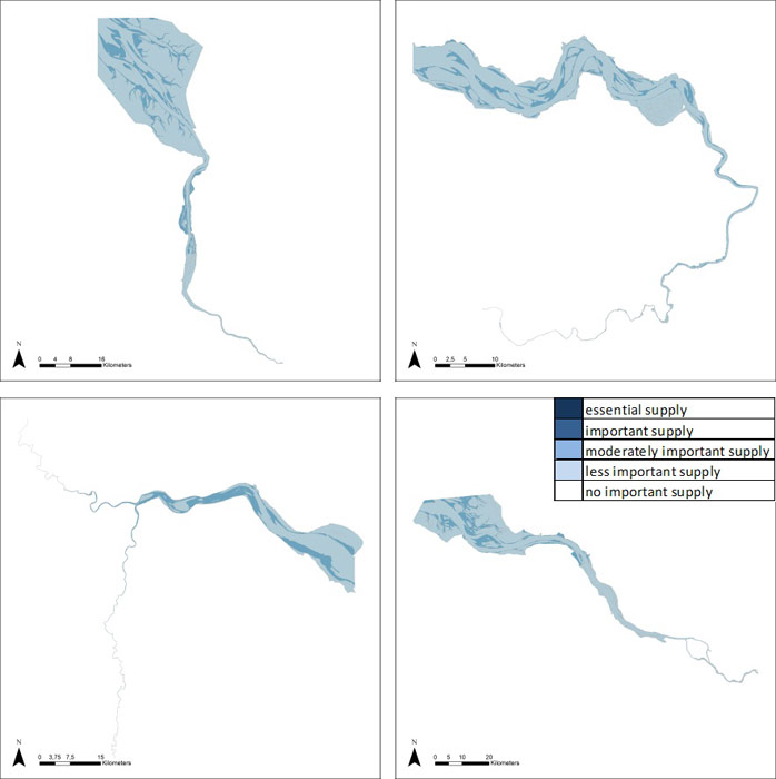
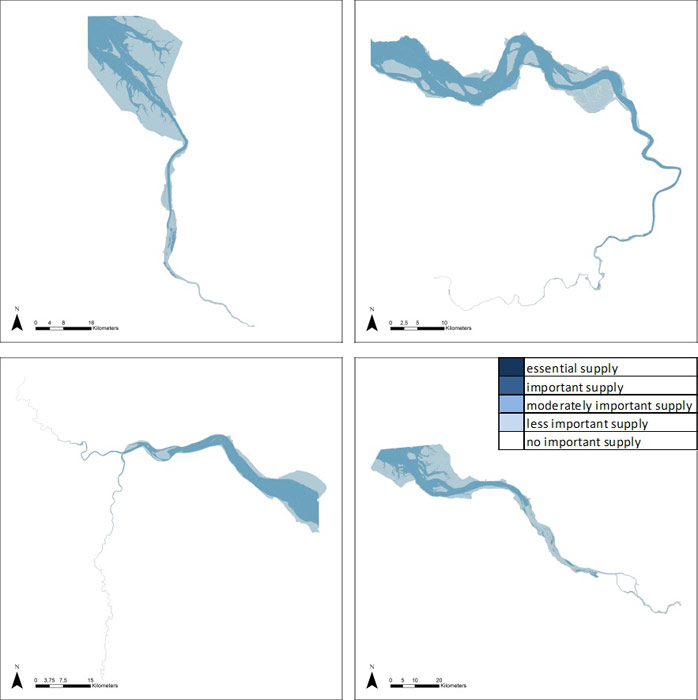
Substantial food provision in estuaries is mainly regarded as historical. Livestock grazing and fodder production on the highly fertile marshes was a common practice, with crops in the freshwater zones and extensive grazing in brackish and salt marshes. Also, direct fishing and shellfish breeding inside estuaries occurred more commonly in history. The higher scores for marshes in the freshwater and oligohaline zone reflect this supply. Although agricultural practices abide in some areas, they have disappeared in many others due to excessive pollution and market shifts. However, estuaries are still regarded highly important as foraging, breeding or spawning ground for commercial fish species which spend part of their live cycle in fresh or brackish water. This is reflected in the higher scores of shallow and moderately deep subtidal areas.
Structures & processes
Food provision is strongly driven by ecological habitat quality and biodiversity. Shallow areas with low hydrological stress (currents, waves, erosion), opportunities for shelter and high benthic productivity are essential, as well as the presence of a full gradient in habitats which are well connected. This service has its main feedback to the supporting / habitat services, positively (increased biodiversity) as well as potentially negatively (e.g. overfishing, habitat modification for increased shellfish productivity).
Quantification and pricing (Liekens et al 2013B) can be performed by estimating the market prices for animals and crops grown in estuarine ecosystems. It is to be noted that, in general, the current benefits (monetary benefits in particular) obtained from biodiversity resources do not often reflect sustainable extraction or production patterns. The external costs related to this issue are not taken into account. The estimated value of the biodiversity resource based on market price is equal to the quantity of sold resource x (market price – costs related to production). Liekens et al (2013B) suggest taking the standard gross margin as indicator.
Provision of water for industrial use
| Service | Benefit | Short definition |
| Water for industrial use | improved industrial production | provision and use of water for e.g. cooling water, rinsing water, water for chemical reactions |
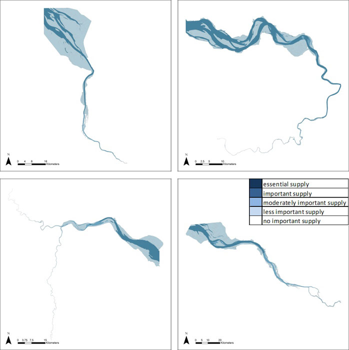
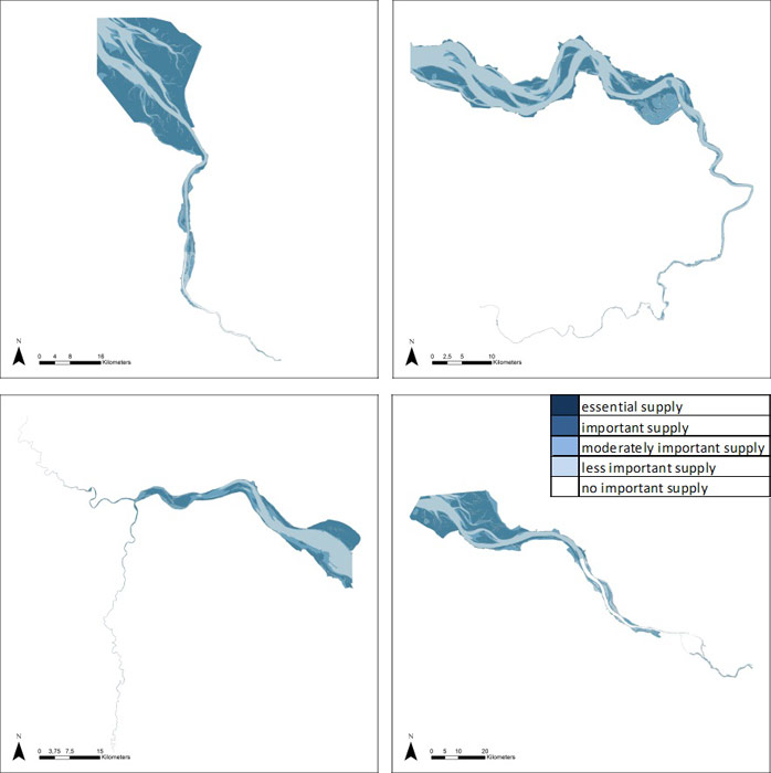
Requirements for industrial use water are not as stringent as for provision of e.g. drinking water, although some industries require fresh water. However, often large amounts are needed in relatively short timespans, which requires the presence of adequate volumes at all times. Deep subtidal habitats are therefore important, and since most industrial activities are often concentrated towards the mouth of estuaries, these deep habitats get a higher score in poly- and mesohaline zones. Using the score matrix does reveal habitat-driven differences, but some specific estuarine supply aspects are lost. For instance, in the Elbe, this service was scored higher in freshwater and oligohaline zones, where most industrial activities are located. These inter-estuarine differences are represented in detail section 5.5.
Structures and processes
This service is mainly physically driven. Main driving factors are the presence of deep water habitat (adequate volumes) as well as the quantities provided by discharge and tidal influx. However, the use of this service impacts on supporting / habitat services since returning of cooling water (often with increased temperatures and algicides) could impact the ecosystem locally: increased productivity or changes in algal community composition, or local microclimate conditions altering composition of higher trophic levels. An important process is the residence time and the volume of the water in the zone where the cooling water is released. This determines the concentration or heating impact.
As an indicator, the volume (m³) water directly taken from the estuary for processing and cooling by industrial sector in the estuary can be used, while the costs of losing or replacing natural water supply or finding an alternative for it can be used as an estimate for its value (Liekens et al 2013B). In addition, opportunity costs, i.e. loss of income foregone due to the loss of water supply, can also be used as an indication for the value.
Provision of water for navigation
| Service | Benefit | Short definition |
| Water for navigation | Shipping | presence and use of water for shipping purposes |
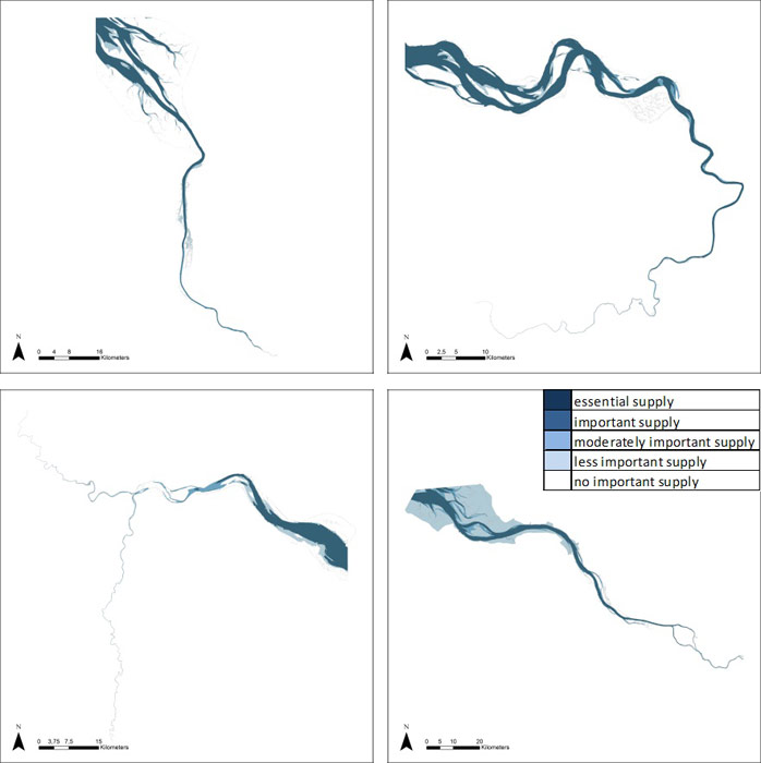
Requirements for navigation use water are straightforward. Water bodies require adequate depths and width, while complex and dynamic morphology as well as sedimentation of these habitats might increase costs for shipping. Scores are highest for deep and moderately deep subtidal habitats, while shallow areas are less important (mainly recreational navigation). Using the score matrix reveal habitat-driven differences, but some specific estuarine supply aspects are lost. For instance, in the Elbe, this service was scored lower in the freshwater zone upstream of the harbour, compared to the other estuaries. These inter-estuarine differences are represented in detail section 5.5. Also, the estuary-specific zonation scores were averaged in the four common zones. In this case it has to be noticed that for instance in the Elbe, the freshwater zone 1 upstream of the harbour (see report “Zonation of the TIDE estuaries”) has a lower score as the zones 2 and 3 downstream the harbour.
Structures and processes
This service is mainly physically driven. Main driving factors are the presence of deep water habitat (adequate volumes) as well as the quantities provided by discharge and tidal influx. However, the use of water for navigation has an impact on supporting / habitat services since dredging and disposal of sediments (often causing increased turbidities or availability of pollutants) could impact the ecosystem locally: direct impacts on benthic communities, decreased light availability and primary productivity or changes in algal community composition, or local conditions altering composition of higher trophic levels. This engenders an impact on all services depending on supporting and habitat services (see section 5.4).
The value of water for navigation is estimated by the prevented costs made by ships not being able to make use of the full loading capacity functions. It is assumed that the costs exist out of more trips to the deliver address or by transport the rest load by another mode: train or truck (Liekens et al 2013B).
Climate regulation: C-sequestration & burial
| Service | Benefit | Short definition |
| Climate regulation: Carbon sequestration and burial | human health, avoided costs caused by extreme events or climate disturbance, ensured provisioning services | buffering carbon stock in living vegetation, burial of organic matter in soils |
As carbon sequestration and burial is linked to biological productivity and sedimentation/burial of sediments; marshes and intertidal areas have the highest scores. Other habitats can also store carbon if they silt up. Inter-estuarine differences among zones and habitats are represented in detail section 5.5.
Structures and processes
Carbon sequestration and burial has both biological and hydrological drivers. Uptake of carbon in the estuarine food web (linked to productivity of algae and vegetation) and long-term sedimentation into deeper soil layers are the main drivers. The fate of this carbon is long term burial or sequestration and potential uptake. This decides whether carbon is removed from the atmosphere on the long term.
Carbon sequestration and burial is only one of the estuarine functions related to climate regulation. It can be regarded as an intermediate service delivering the final service of climate regulation. Other intermediate services include direct cooling effect of water bodies, cooling effects of vegetation, processes related to production of methane and other greenhouse gasses etc. These are all related and should be addressed together.
In Liekens et al (2013B), an extensive literature review on this topic can be found. Here, some basic processes are described: Estuarine ecosystems are extremely productive biologically (Bianchi, 2007), with net primary production rates among the highest of the world. Consequently, these systems play globally an important role as carbon sinks (Chmura et al., 2003).
Sediment carbon is oxidized by microbial mediation to other species, including, among others, carbon dioxide (CO2), methane (CH4) and nitrous oxide (N2O). Production of these gases is potentially important since they are greenhouse gases (GHGs), all with a different Global Warming Potential. GWPs are measures of the contribution towards global warming and integrate a gas’ radiative absorption ability, its atmospheric residence time, the frequency of radiation which it absorbs and any indirect effects by feedbacks (Forster et al., 2007). Over a 100 year frame the GWPs of CO2, CH4 and N2O are 1, 25 and 298 respectively (Forster et al., 2007); meaning that 1 tonne of N2O would affect global warming as much as 198 tonnes of CO2. These GWPs are in fact carbon dioxide equivalents (CO2eq). Applying these GWPs to the GHG flux data, and converting the C burial into CO2 equivalents allows this data to be directly compared, permitting the calculation of net CO2eq-fluxes.
Carbon is sequestered when the net effect of all CO2eq-fluxes is negative; this occurs when more carbon enters a system, than the amount of carbon that will leave the system.
C sequestration = C-burial + (CO2+CH4+N2Ofluxes) (+ long lasting biomass)
Short-term carbon sequestration occurs in biomass, long-term carbon storage would be based on carbon removed over app 100 years (Crooks et al., 2010) and therefore only sequestration in sediments is taken into account.
Long lasting biomass might be an important long-term carbon pool too, especially when it concerns trees (mangroves,…). Hereto also belowground biomass has to be accounted for. Furthermore, due to sea level rise, sedimentation is an ongoing process and so is the sequestering capacity.
Flood water storage
| Service | Benefit | Short definition |
| Regulation extreme events or disturbance: Flood water storage | human health, avoided costs caused by extreme events or disturbance, ensured provisioning services | storage of storm or extreme spring tides in natural or flood control habitats |
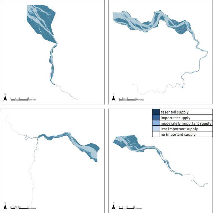
Flood water storage is beneficial as the water volume which causes flooding of properties is stored in areas where the damage is lower or zero. This is reflected in the highest scores for marsh habitat in upstream zones. Large differences between estuaries occur, as marsh habitats are much more abundant (relatively) in the Weser (and to a lesser extent in the Elbe), while in the Humber and Scheldt, these are very small in surface. In the poly- en mesohaline zone subtidal habitats play a role as determining factor for the amount of water coming into the estuarine funnel, and direct storage above marshes is moderately important (except for the large ‘Land van Saeftinghe’ area in the mesohaline zone of the Scheldt). Inter-estuarine differences among zones and habitats are represented in detail section 5.5.
Structures and processes
This service is entirely physically driven. The shape and volume of the estuary in the poly- and mesohaline zone determines the volume and speed of the tidal wave, while the extent of intertidal and mainly marsh habitat (which is close to critical elevation for flooding) determines the amount of flood water potentially stored. Complex interactions with water quantity-influenced services exist, as the tidal propagation influences sedimentation-erosion balances. However, there are also potential synergies with habitat and supporting services, as marshes or flooding areas can be essential biodiversity hotspots.
Concerning quantification, Liekens et al (2013B) note that services related to disturbance prevention or moderation reduce flood risk. The benefits of flood alleviation comprise the flood damage averted in the future as a result of schemes to reduce the frequency of flooding or reduce the impact of that flooding on the property and economic activity affected, or a combination of both. This is reflected in less material and immaterial damages. It is not possible to translate the assessment methods into easily applicable indicators that can be applied in different estuaries. However, the principles of this method are accepted internationally. Liekens et al (2013B) refer to FHRC 2010 the benefits of flood and Coastal Risk management: a handbook of assessment techniques 2010 for a stepwise approach to assess the benefits of flood prevention.
Water current reduction
| Service | Benefit | Short definition |
| Regulation of extreme events or disturbance: Water current reduction | human health, avoided costs caused by extreme events or disturbance, ensured provisioning services | reduction of water current by physical features or vegetation |
Intertidal habitats and shallow zones are scored as more important for reducing water currents than other habitat types. Water current reduction takes place at different levels: morphological structures reduce water current in subtidal (except in the freshwater area, where this is less important) as well as intertidal habitats. Reduction of this current decreases shear stress and incoming tidal volumes. On intertidal habitats, and especially on marshes, organism structures (vegetation) are also known to strongly reduce water current. This reduces erosion of protective natural or technical infrastructures. Inter-estuarine differences among zones and habitats are represented in detail section 5.5.
Structures and processes
Reduction of water current as an ecosystem service, is physically driven, but on marshes, biological structures also exert this physical role. Apart from direct damage to infrastructures, excessive water currents also cause potential excessive erosion in the estuarine system, disturbed benthic population dynamics, high turbidity and hence impacts on primary production of the algal community. It interacts with all ecosystem services linked to water quantity.
Wave reduction
| Service | Benefit | Short definition |
| Regulation of extreme events or disturbance: Wave reduction | human health, avoided costs caused by extreme events or disturbance, ensured provisioning services | reduction of wave height by physical features or vegetation |
Intertidal areas and shallow zones get the higher scores. Reduction of waves decreases erosion of marsh edges and protective infrastructure. Inter-estuarine differences among zones and habitats are represented in detail section 5.5.
Structures and processes
Wave reduction is a service which is physically driven, but on marshes, biological structures also exert this physical role. Wave reduction is a physical process. Waves, generated by wind or ships, are attenuated by physical structures or organisms, mainly vegetation. Apart from direct damage to infrastructures, excessive waves cause potential excessive erosion in the estuarine system, which consequences as disturbed benthic population dynamics, high turbidity and hence impacts on primary production of the algal community. It interacts with all ecosystem services linked to water quantity.
Drainage of river water
| Service | Benefit | Short definition |
| Water quantity regulation: drainage of river water | ensured platform, food, water other provisioning services | drainage of the catchment by the river |
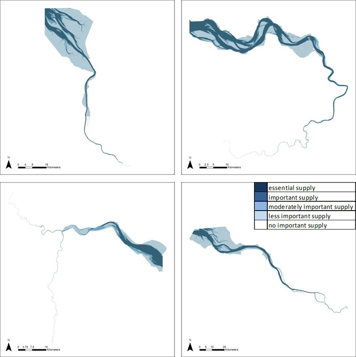
Drainage of river water is a basic but essential process of evacuating water from the catchment, which guarantees basic activities performed in the estuarine valley. Especially, evacuation of the river water after a storm tide is very important as storm tides are often coinciding with heavy rainfall (and potential high discharges from the catchment), and emptying the estuary is essential to prevent flooding by consequent surges. It is provided by the deep subtidal habitat mainly, but also other habitats play their role as temporary discharge buffers. Inter-estuarine differences among zones and habitats are represented in detail section 5.5.
Structures and processes
Drainage of river water is physically driven. It consists of the connection of the catchment with the estuary, the buffering potential of discharge in intertidal areas, and the evacuation of water out of the estuary in between tides. It interacts with all ecosystem services linked to water quantity. Optimal drainage requires an open and free flow, but on the other hand this might increase the tidal volume coming in (see section 5.3.5, 5.3.6). Tidal amplitude and tidal asymmetry and its links with morphology are essential drivers.
Dissipation of tidal and river energy
| Service | Benefit | Short definition |
| Water quantity regulation: dissipation of tidal and river energy | various ensured provisioning services, avoided maintenance costs | buffering of average flood and discharge variations in the river bed |
This service is very similar to flood protection, but while flood protection is linked to extreme events and storm flood volumes (highest intertidal habitats), dissipation is the regulating process for everyday tidal volumes. Too high river or tidal energies exert continuous hydrological stress on habitat & supporting services and on infrastructures, mainly through excessive water currents and erosion. Dissipation occurs in shallow areas and intertidal areas. Inter-estuarine differences among zones and habitats are represented in detail section 5.5.
Structures and processes
This ecosystem service is almost entirely physically driven. The shape and volume of the estuary in the poly- and mesohaline zone determines the volume and speed of the tidal wave, while the extent of intertidal habitats determine the amount of energy potentially dissipated. Complex interactions with water quantity-influenced services exist, as the tidal propagation influences sedimentation-erosion balances. However, there are also potential synergies with habitat and supporting services, as intertidal areas can be essential biodiversity hotspots.
Landscape maintenance
| Service | Benefit | Short definition |
| Water quantity regulation: landscape maintenance | various ensured services | formation and maintenance of typical landscapes and hydrology |
This service describes the ensemble of natural processes which ensure an equilibrium in sedimentation (= formation of new habitats) and erosion (= decrease in older habitats). Essential are sedimentation areas in shallow water and intertidal flats, which allow emergence of new habitats at young succession stages, which are often lacking from highly dynamic zones. However, the erosion of tidal marshes is an evenly important process. Overall, this service can be regarded as an intermediate service to many final services. Its delivery could be evaluated by assessing the long-term trends in habitats ratio’s and equilibria between marsh formation and erosion. Inter-estuarine differences among zones and habitats are represented in detail section 5.5.
Structures and processes
This service is driven by sedimentation erosion processes and thus mediated by morphological as well as biological processes and structures. Morphology and water quantity related services are strongly interacting, but the presence of complete gradients and specific habitats is essential for the biological and morphological functioning of the estuary. These processes generally play a role in any habitat, but most importantly in the shallow water and intertidal habitats.
Water quantity regulation for navigation
| Service | Benefit | Short definition |
| Water quantity regulation: transportation | Shipping | discharge and tidal input for shipping, including water use for canals and docks |
Requirements for navigation use water are straightforward. Water bodies require adequate depths and width. This is an intermediate service for the final provision of water for navigation (section 5.3.3). The complex and dynamic morphology is regulated by water quantity and morphology aspects, which can cause erosion as well as sedimentation of the fairway, which might increase (dredging) costs for shipping. Scores are highest for deep and moderately deep subtidal habitats where these processes impact directly on accessibility, while shallow areas are important as sedimentation areas. Inter-estuarine differences among zones and habitats are represented in detail section 5.5. Notice, that the estuary-specific zonation scores were averaged in the four common zones. In this case notice that for instance in the Elbe, the freshwater zone 1 upstream of the harbour “Zonation of the TIDE estuaries”) has a lower score as the zones 2 and 3 (see report downstream the harbour.
Structures and processes
This ecosystem service is mainly physically driven. Main driving factors are the water quantities provided by discharge and tidal influx and the morphology of the fare way. The service is interacting with supporting & habitat services by direct impacts on benthic communities, light availability and productivity or changes in algal community composition, or local conditions altering composition of higher trophic levels.
Water quantity regulation services
The former four services al relate to regulation of water quantity. Concerning their identification, quantification and valuation, Liekens et al (2013) state that ecosystems, e.g. forests and wetlands, play an important role in the hydrological cycle including regulating the provisioning of water, i.e. “capturing” quantities of water for human or other use (including both surface and ground water). One of the important uses in an estuary is transportation defined as the discharge and tidal input for shipping, including water use for canals and docks. From the ecosystem functioning point of view, water regulation services are based on the combined effects of vegetation and soil characteristics. Vegetation cover maintains certain soil characteristics, e.g. permeability, that enable infiltration of rain water into the ground. Reduced vegetation cover can thus increase surface runoff and decrease infiltration, resulting in lower recharging of the groundwater reserves. In general, all ecosystems use water, e.g. water is required for photosynthesis to take place. Consequently, vegetation cover inherently reduces fresh water quantities and the quantity of water taken up by vegetation increases. Liekens et al (2013) further describe interaction with other services and suggest quantification methods per use category (industry, transport, agriculture,…).Transport of pollutants and nutrients
| Service | Benefit | Short definition |
| Water quality regulation: transport of pollutants and excess nutrients | improved water quality, various ensured services | transport of pollutants from source, dilution |
This service describes the basic physical removal of pollutants and excess nutrients out of the system by dissolution in the estuaries water mass and transport towards the sea. The scores are very similar to e.g. drainage of river water with a decreasing importance of habitats higher in the tidal frame. Inter-estuarine differences among zones and habitats are represented in detail section 5.5.
Structures and processes
This service is mainly physically driven. Main driving factors are the water quantities provided by discharge and tidal influx and the morphology of the river. The service is heavily interacting with supporting & habitat services, since excessive loads of nutrients or pollutants will impact benthic communities, algal community composition, or higher trophic levels, and overall functioning of the estuarine ecosystem.
Filter function: Reduction of excess nutrient loads
| Service | Benefit | Short definition |
| Water quality regulation: reduction of excess loads coming from the catchment | improved water quality, various ensured services | binding of N, P in sediments and pelagic food web |
This service describes the filter function of the estuary by uptake of nutrients and pollutants in the ecosystem (biologically by uptake of organisms, of physically by sedimentation and chemical absorption and immobilization). Highest scores are found on areas where high biological activity coincides with high sedimentation rates. Marshes are particularly important. However, also in the pelagic food web, nutrients are being sequestered. Inter-estuarine differences among zones and habitats are represented in detail section 5.5.
Structures and processes
This service is mainly biologically driven. Main driving factors are the productivity of algal communities and the biologically active layer on subtidal and intertidal sediments. However, hydrology plays an essential role as it determines retention times, flooding frequencies and duration, and evenly important are sediment features and morphology which determine pelagic light climate, intertidal soil porosity and reactivity etc. The service is heavily interacting with supporting & habitat services, since excessive loads of nutrients or pollutants will impact benthic communities, algal community composition, or higher trophic levels, and overall functioning of the estuarine ecosystem.
In Liekens et al (2013B) the importance and complexity of identifying, quantifying and valuing this service is illustrated (see also 5.2.)
Erosion & sedimentation regulation by water bodies
| Service | Benefit | Short definition |
| Erosion and sedimentation regulation by water bodies | avoided damage or maintenance costs, various ensured provisioning services | sediment trapping and gully erosion by variable water currents and topography |
This service is the purely physical regulation of erosion and sedimentation processes occurring in estuaries. All habitats are important, since deep subtidal as well as shallow subtidal and intertidal habitats play essential roles in regulation of sedimentation and erosion. Marshes and tidal flats however are scored highest, as they tend to accumulate sediments, avoiding sedimentation in deep subtidal and providing natural habitat formation. Inter-estuarine differences among zones and habitats are represented in detail section 5.5.
Structures and processes
This service is mainly physically driven. Main driving factors are the position of the habitat in the tidal frame, and the local dynamics and water currents. Processes and structures are linked to the service of landscape maintenance (5.3.10).
Erosion & sedimentation regulation by biological mediation
| Service | Benefit | Short definition |
| Erosion and sedimentation regulation by biological mediation | avoided damage or maintenance costs, various ensured provisioning services | sediment trapping and erosion prevention by vegetation, effects of bioturbation |
This is the biological component of regulation of erosion and sedimentation processes occurring in estuaries. All habitats are important, since biota in deep subtidal (benthic organisms) as well as in shallow subtidal and intertidal habitats play potential roles in regulation of sedimentation and erosion. Marshes and tidal flats however are scored highest, as vegetation plays a major role as ecological engineer by preventing erosion, determining sedimentation-erosion patterns and driving changes in marsh morphology and tidal flat elevation. Inter-estuarine differences among zones and habitats are represented in detail section 5.5.
Structures and processes
This service is mainly biologically driven, and together with its physical counterpart (5.3.14), these can be regarded as intermediate services for landscape maintenance (5.3.10). These services determine abundance of different structures and gradients and services emerging from them. Main driving factors are the ecological quality of the habitat, the presence and viability of populations of key species, the habitat connectivity and colonization dynamics. Important processes include water current reduction and sediment capturing (in subtidal shallow and intertidal vegetation), bioturbation (e.g. by benthic macrofauna) and increasing resistance against erosion (e.g. benthic algal layers).
Supporting / habitat services
| Service | Benefit | Short definition |
| "Biodiversity" | insurance of all services | total amount of abiotic and biotic diversity at all levels (gene-landscape), regardless of rarity or vulnerability |
Biodiversity, broadly defined, contains all processes directly or more indirectly involved in sound ecosystem functioning. Hence the importance of all habitats. Resilience of the ecosystem increases with biodiversity. Resilience of a system is the capacity to recover from impacts, anthropogenic as well as natural. In estuarine ecosystems, this resilience is of key importance since stress (long term) and disturbance (events) are inherently part of the estuarine ecotope. In terms of ecosystem services, resilience can be defined as “the ability to provide regulating services under varying circumstances”. As estuarine ecosystems are intensively used, and impacts of this use on basic processes are significant, determining the risk of losing this resilience is essential.
Therefore, profound and integrated understanding of the estuarine system and the appearance of thresholds, regime shifts and tipping points is needed, as well as quantification of scientific uncertainties in order to adequately address the precautionary principle. Inter-estuarine differences among zones and habitats are represented in detail section 5.5.
Structures and processes
This service is the ensemble of all biological processes playing at all levels (gene-landscape)
Cultural services
| Service | Benefit | Short definition |
| Aesthetic information | Wellbeing | appreciation of beauty of organisms, landscapes,… |
| Opportunities for recreation & tourism | Wellbeing | opportunities and exploitation for recreation & tourism |
| Inspiration for culture, art and design | Wellbeing | appreciation of organisms, landscapes,… as inspiration for culture, art and design |
| Information for cognitive development | Wellbeing | use of organisms, landscapes for (self-) educational purposes |
Most cultural services score high all over habitats. Marshes, as they provide a more accessible and visible biodiversity, score slightly higher for the ‘inspiration’ service. Inter-estuarine differences among zones and habitats are represented in detail section 5.5.
Structures and processes
These services are driven by the ensemble of abiotic, biotic and human processes and structures in estuaries. Although very valuable and essential for society, they are hard to quantify and capture in decision making.
Important to know
Reports / Measures / Tools
| Tool: | Ecosystem service trade-off risk tool (Decision support) |
|---|---|
| Tool: | Mapping tool for estuarine ecosystem service supply (Decision support) |
| Tool: | Survey tool for screening of estuarine ES demand and supply (Methodology) |
| Tool: | Defining Conservation goals based on Ecosystem Services in the Scheldt (Examples of good practice) |
Management issues
How can ecosystem services of estuaries be valued?How can public acceptance for management actions be increased?
How can the Ecosystem Services Approach be used to support management decisions?
How do TIDE estuaries deal with management problems?
How does habitat management affect the supply of ecosystem services?
How does the societal demand for ecosystem services vary along the estuary gradient?
What are the key areas of conflicts or synergies in TIDE estuaries?
What is important in establishing a zonation for estuaries?
Which aspects do I have to take into account in order to make a measure a success?
Which measures are suitable to achieve specific ecological targets?
Which measures are suitable to provide ecosystem services and benefits?
Which synergistic effects and conflicts can be expected by planning and implementing a certain measure?
“Working with nature”: What are the opportunities for sediment management in estuaries?
