
Disclaimer:
The authors are solely responsible for the content of this report. Material included herein does not represent the opinion of the European Community, and the European Community is not responsible for any use that might be made of it.
Back to overview reports
Plans and Schemes in the table are colour coded and relate to:
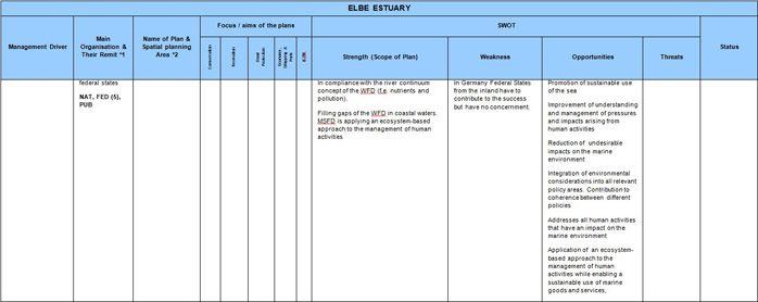
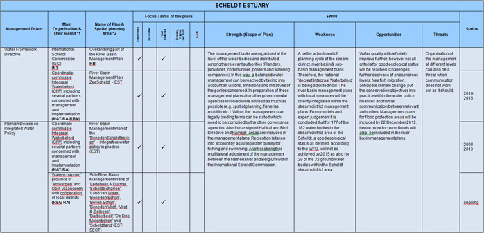
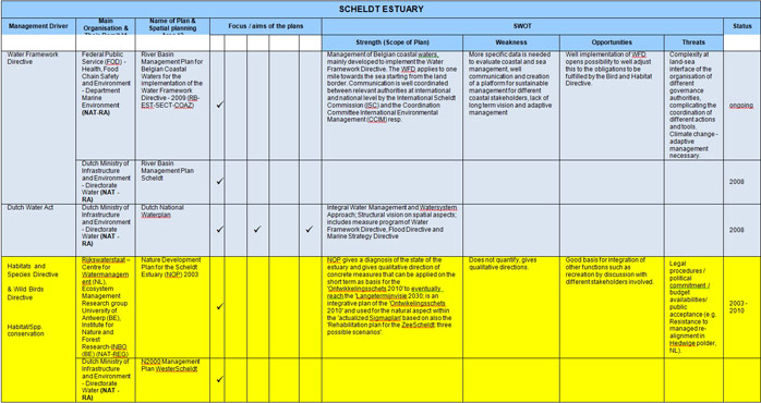
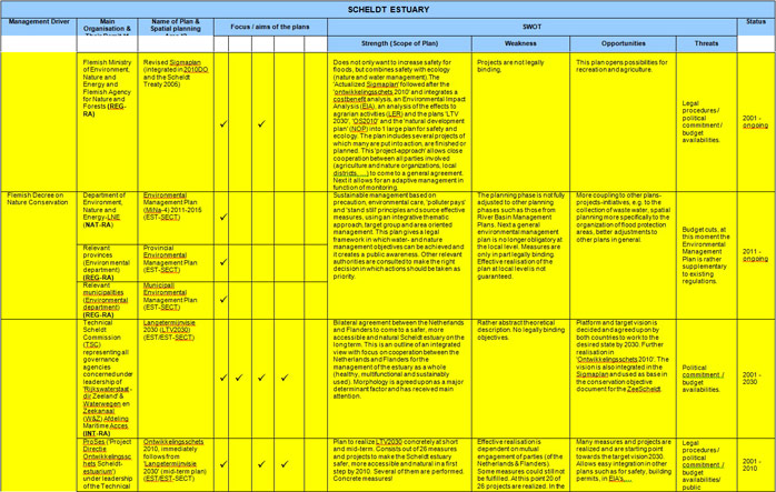
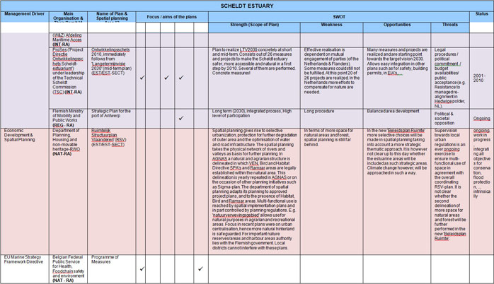
In the last decade, management of the Scheldt estuary has been worked out not only on a transnational basis (The Netherlands (NE) – Flanders (FL)) but also in a multi-sectoral way. A global Long Term Vision (LTV – 2001) has been implemented in a 2010 Development Outline (2010DO – 2005) which has been translated in a Scheldt Treaty (2005). Some sectoral plans listed below are part of this multi-sectoral policy plans. Where this is the case, it is mentioned between brackets.
Back to top
What tool is available to help manage multiple users of a resource in an integrated way (i.e. achieving more holistic management)?
Legislative Drivers & Sectoral Plan Review of TIDE Estuaries
Table of content
- 1. Introduction
- 1a. Overview
- 1b. Methodology
- 2. Management Drivers
- 2a. Birds Directive (2009/147/EC) & Habitats Directive (92/43/EEC)
- 2b. Water Framework Directive (2000/60/EC)
- 2c. Marine Strategy Framework Directive (2008/56/EC)
- 2d. Flood Risk Management Directive (2007/60/EC)
- 3. Key Players and Management Structures
- 3a. Humber Estuary
- 3b. Elbe Estuary
- 3c. Weser Estuary
- 3d. Scheldt Estuary
- 4. Management Plans & SWOT Analysis
- 4a. Management Plans
- 4b. SWOT Analysis
- 4c. SWOT Tables
- 5. Conclusions
- 5a. Environmental Drivers
- 5b. Best Practice
- 5c. SWOT
Authors:
By: Boyes, S., Cutts, N.D. & Elliott, M.
Supported by: Wild-Metzko S., Knüppel J., Saathoff S., Hürter D., Kress J., Roose F., Geerts L.
By: Boyes, S., Cutts, N.D. & Elliott, M.
Supported by: Wild-Metzko S., Knüppel J., Saathoff S., Hürter D., Kress J., Roose F., Geerts L.
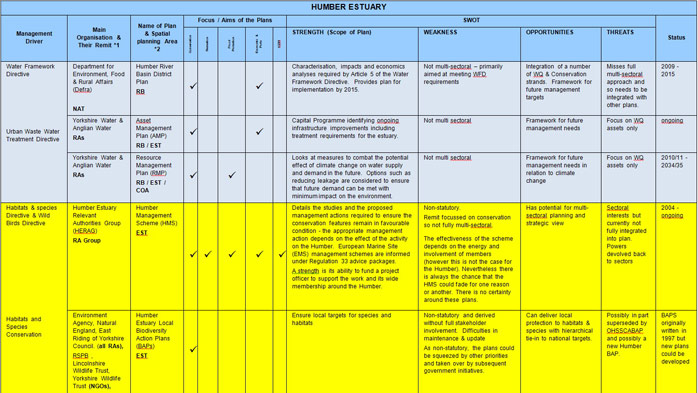
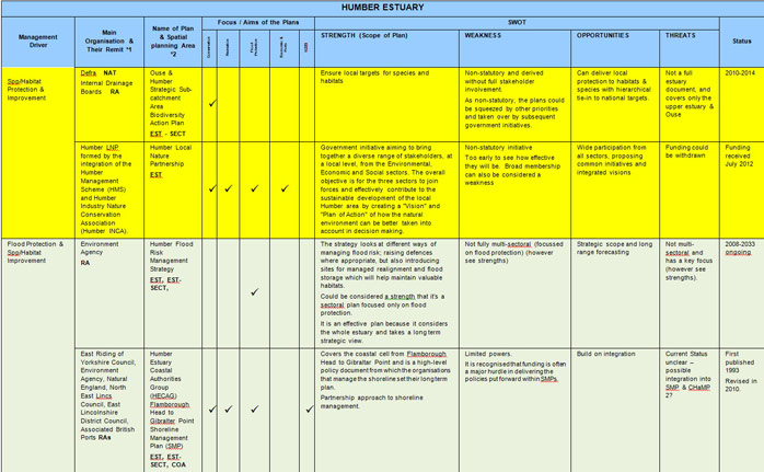
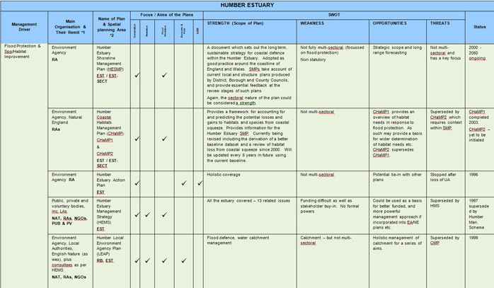
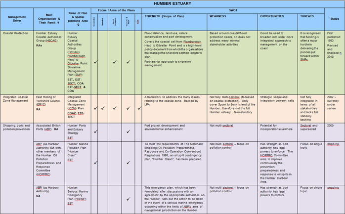
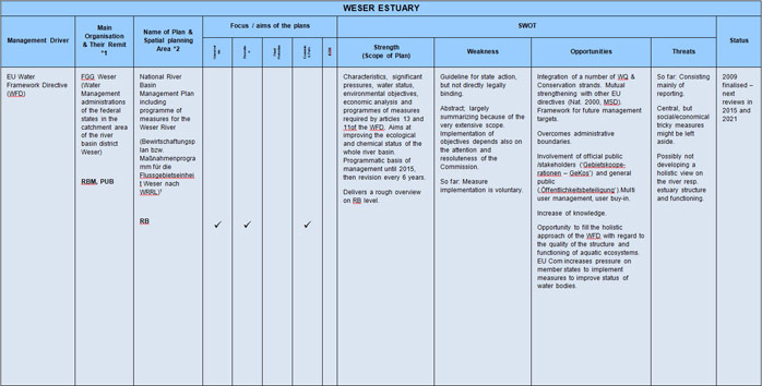
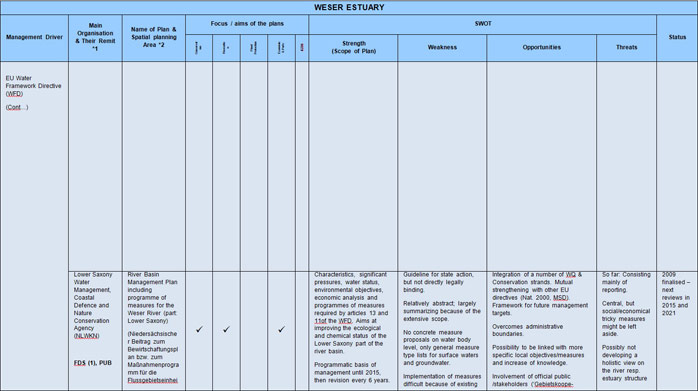
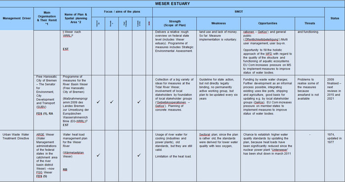
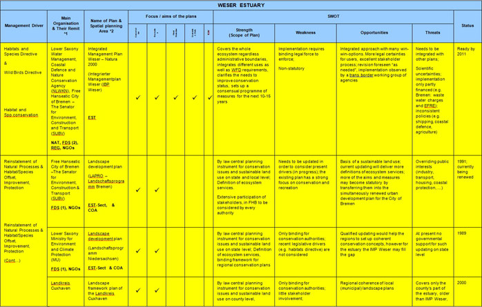
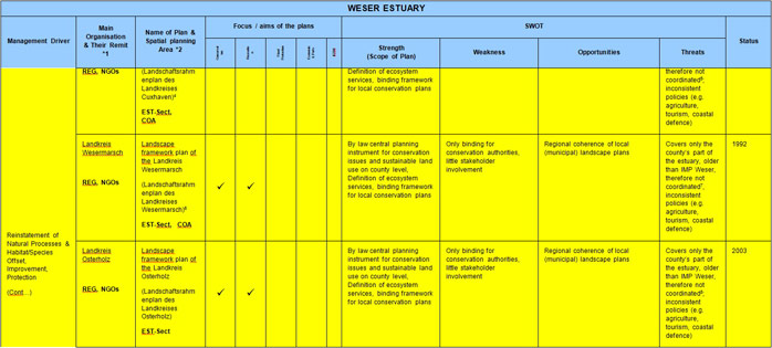
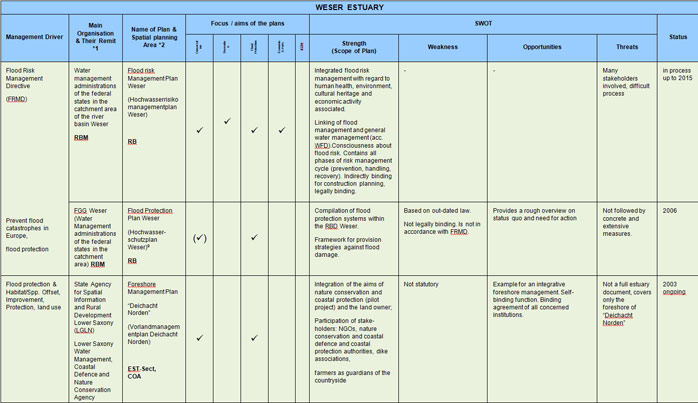
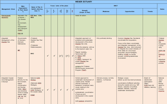
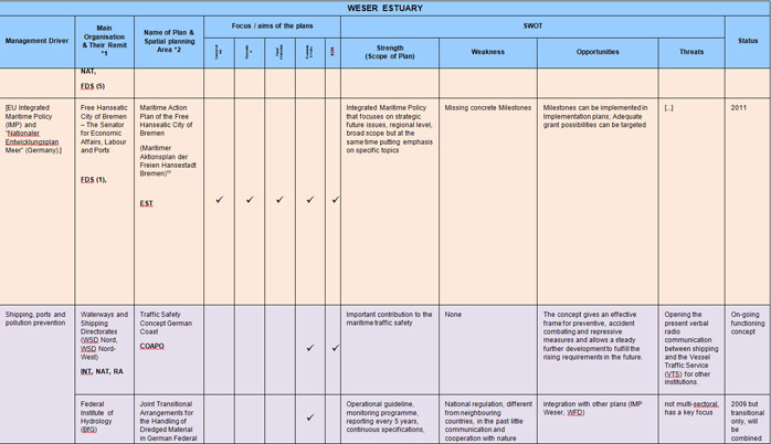
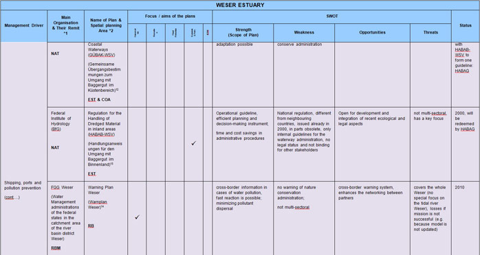
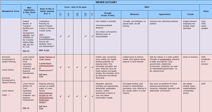
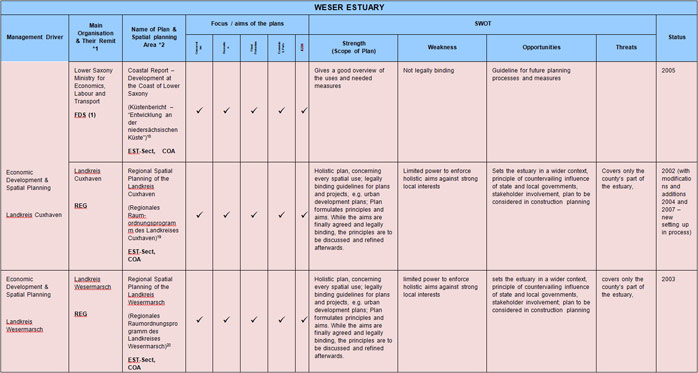
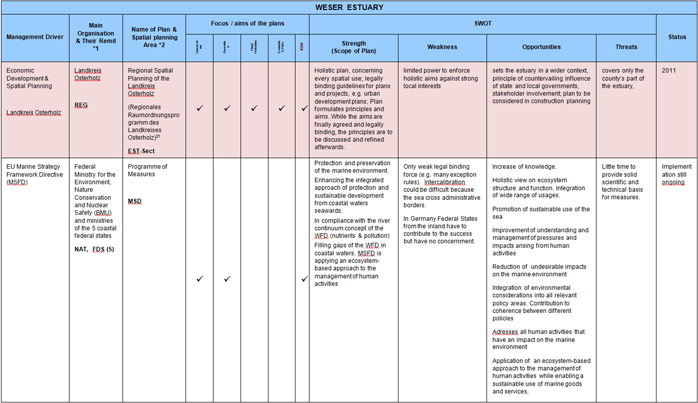
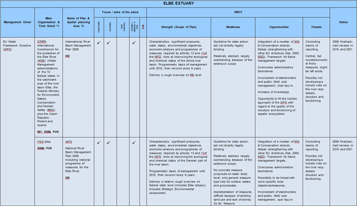
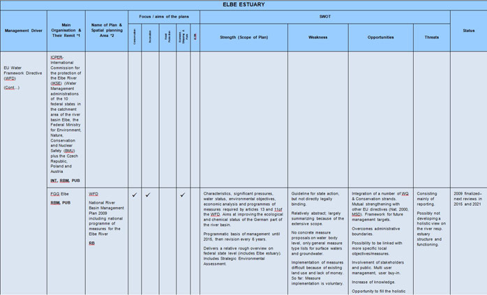
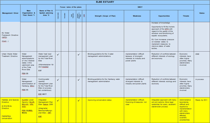
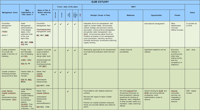
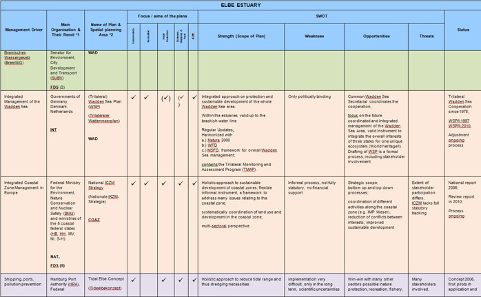
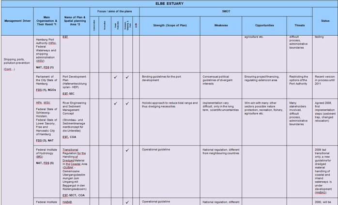
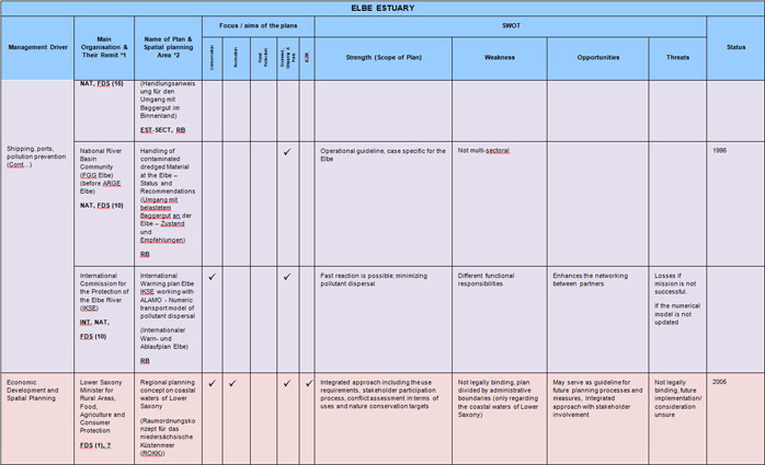
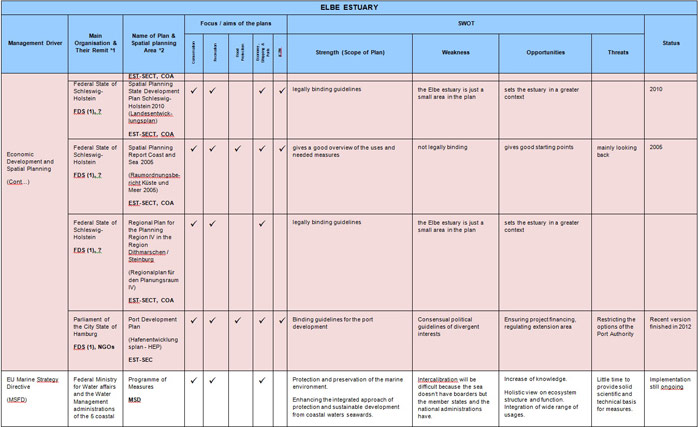
4c. SWOT Tables
Abbreviations and acronyms in bold in Tables 5 to 8 are described below:| *1 Categories for spatial scope of participants | |
| EU | - European level |
| INT | - International level |
| NAT | - National level (Government Bodies, Federal Ministries and their agencies, institutes and administration units) |
| RA | - Relevant Authority |
| RBM | - River Basin Management level (national, including the 5 Federal states and the Federal Ministries) |
| FDS | - Federal State level (Federal State Ministries and their agencies and administration units) (1)-(5) number of states involved |
| REG | - Regional level (Kreise und Gemeinden) |
| NGOs | - Non-Governmental Organisation (e.g. nature conservation organisations or other stakeholder groups e.g. according to agricultural use, tourism, hunting) |
| *2 Scope of Planning Area | |
| RB | - River Basin (National/International) |
| EST | - Estuary /Tidal River (may include land) |
| EST-SECT | - Estuary /Tidal River sections /subdivisions (may include land) |
| COA | - Coastal water (< 12 nm) |
| COAZ | - Coastal Zone (including EEZ and land) |
| COAPO | - EEZ and Tidal River up to the Ports |
| MSD | - Marine Strategy Directive (from Baseline to EEZ) |
| WAD | - International Wadden Sea (Denmark, Germany, Netherlands) |
Plans and Schemes in the table are colour coded and relate to:
- River Basin Management & Water Quality (Water Framework Directive & Urban Waste Water Treatment Directive)
- Nature Conservation (Habitats & Species Directive & Wild Birds Directive)
- Flood Protection & Species/Habitat Improvement (Flood Risk Management Directive)
- Coastal Protection
- Integrated Coastal Zone Management
- Shipping, Ports and Pollution Prevention
- Economic Development & Spatial Planning
- EU Marine Strategy Framework Directive
In the last decade, management of the Scheldt estuary has been worked out not only on a transnational basis (The Netherlands (NE) – Flanders (FL)) but also in a multi-sectoral way. A global Long Term Vision (LTV – 2001) has been implemented in a 2010 Development Outline (2010DO – 2005) which has been translated in a Scheldt Treaty (2005). Some sectoral plans listed below are part of this multi-sectoral policy plans. Where this is the case, it is mentioned between brackets.
Important to know
Reports / Measures / Tools
| Report: | Management measures analysis and comparison |
|---|
Management issues
What are the relative strengths and weaknesses of different TIDE management plans and actions?What tool is available to help manage multiple users of a resource in an integrated way (i.e. achieving more holistic management)?
