

Disclaimer:
The authors are solely responsible for the content of this report. Material included herein does not represent the opinion of the European Community, and the European Community is not responsible for any use that might be made of it.
Back to overview measures
The monitoring program is included in the global monitoring of the Scheldt estuary (Moneos) plus monitoring of variables that give information about evolution and success of restoration, most intensively immediately after restoration with declining frequency thereafter. At each of the project sites changes in geomorphology, sediment characteristics, sediment quality, vegetation, macrozoobenthos, avifauna and fish were studied in the first years after restoration. Eight monitoring locations were used on the Paardenschor for sampling sediment and benthos (Figure 3).
Changes in geomorphology (sedimentation and erosion) were evaluated on three different spatial scales: locally with sedimentation/erosion plots (‘sederplots’), along trajectories perpendicular to the river with Real Time Kinematic-GPS and full cover with LIDAR (Laser Imaging Detection And Ranging) and aerial photography (DTMs - Digital Terrain Models). A Riegl scanner was used for studying geomorphological changes. Changes in the creek pattern were studied using orthophotos. Other aspects that were monitored primarily during the first years after restoration were: development of vegetation, sediment quality (grain size, % organic, pigment concentration (chlorophyl a), fysicochemistry), colonisation by macrozoobenthos (including oligochaeta), fish, and the use of the area by water birds. These developments were compared as much as possible to the situation on nearby tidal wetlands.
Back to top
Paardenschor wetland - small scale brackish tidal wetland restoration in the Sea Scheldt (Zeeschelde)
Table of content
- 1. Description of measure
- 1a. Measure description
- 1b. Monitoring
- 1c. Monitoring results
- 2. Execution of main effectiveness criteria
- 2a. Effectiveness according to development targets of measure
- 2b. Impact on ecosystem services
- 2c. Degree of synergistic effects and conflicts according to uses
- 3. Additional evaluation criteria in view of EU environmental law
- 3a. Degree of synergistic effects and conflicts according to WFD aims
- 3b. Degree of synergistic effects and conflicts according to Natura 2000 aims
- 4. Crux of the matter
- 5. References
Additional information
for this measure:
No further information available.
for this measure:
No further information available.
Monitoring
The monitoring program is still in progress. In 2011 a second report on the project monitoring for the period 2006-2009 was published (Speybroeck et al. 2011).The monitoring program is included in the global monitoring of the Scheldt estuary (Moneos) plus monitoring of variables that give information about evolution and success of restoration, most intensively immediately after restoration with declining frequency thereafter. At each of the project sites changes in geomorphology, sediment characteristics, sediment quality, vegetation, macrozoobenthos, avifauna and fish were studied in the first years after restoration. Eight monitoring locations were used on the Paardenschor for sampling sediment and benthos (Figure 3).
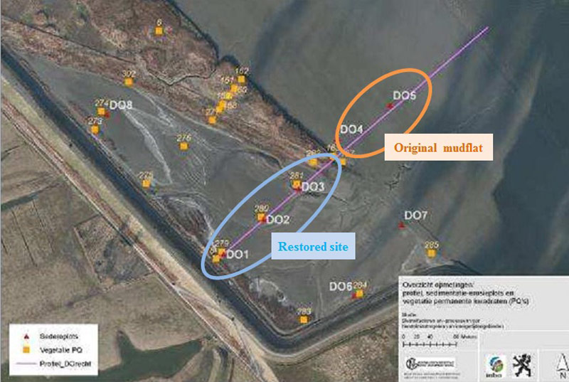
Changes in geomorphology (sedimentation and erosion) were evaluated on three different spatial scales: locally with sedimentation/erosion plots (‘sederplots’), along trajectories perpendicular to the river with Real Time Kinematic-GPS and full cover with LIDAR (Laser Imaging Detection And Ranging) and aerial photography (DTMs - Digital Terrain Models). A Riegl scanner was used for studying geomorphological changes. Changes in the creek pattern were studied using orthophotos. Other aspects that were monitored primarily during the first years after restoration were: development of vegetation, sediment quality (grain size, % organic, pigment concentration (chlorophyl a), fysicochemistry), colonisation by macrozoobenthos (including oligochaeta), fish, and the use of the area by water birds. These developments were compared as much as possible to the situation on nearby tidal wetlands.