
Disclaimer:
The authors are solely responsible for the content of this report. Material included herein does not represent the opinion of the European Community, and the European Community is not responsible for any use that might be made of it.
Back to overview measures
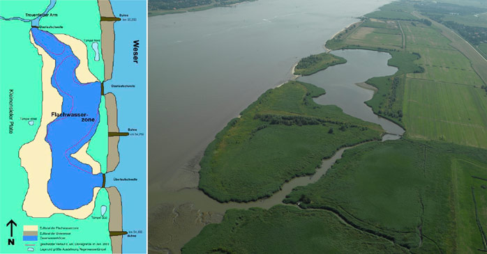
The project area of the compensation measure is situated at the western shore of the lower Weser River between Nordenham and the ferry terminal Kleinensiel (Figure 2). On a 58 ha former disposal area, a typical habitat succession including tidal waters, reeds, bushes and wide grassland was established.
A 10.5 ha shallow water zone -designed as tidally influenced water permanently covered with water and connected to the river by three overflow barriers- was created. The three overflow barriers were installed 0.5 m below mean high water level and guarantee a minimum water level of 2 m within the shallow water zone. By forming the banks of the shallow water area, the site specific conditions for the settlement of different structured reeds were created. Reed development was left to natural succession.
In order to avoid disturbances, shallow water zone and adjacent reed belt are surrounded by a 39.4 ha extensively used buffer zone.
To ensure surface drainage and as a natural barrier, a new ditch was built. Additionally, several existing ditches were dammed. In order to promote the development of perennial and ruderal meadows and woods, small scale site specific differences were initiated by irregular surface design.
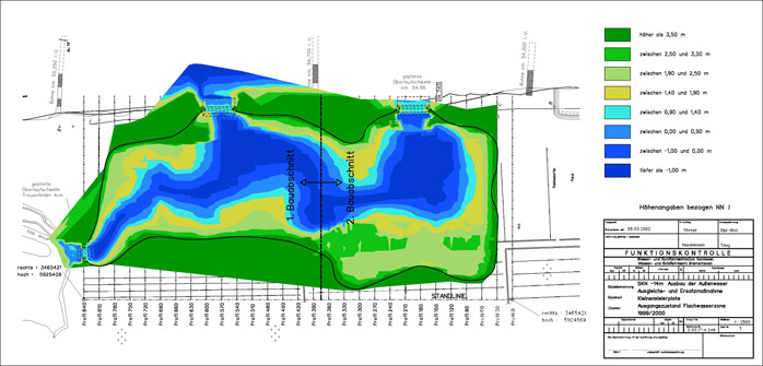
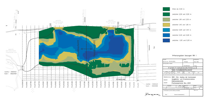
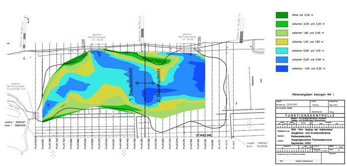
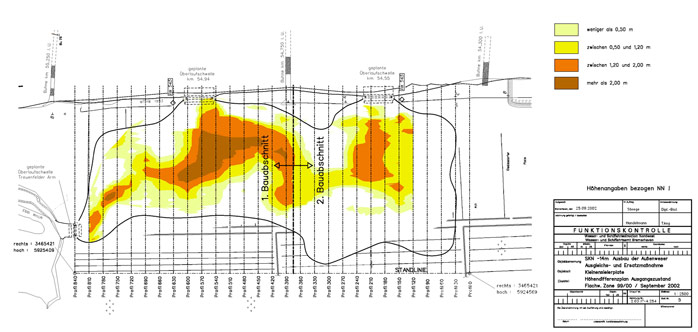
Due to strong siltation tendencies (Figure 3), the shallow water zone was maintained during winter 2004/2005 and the overflow barriers directly connected to the Weser river were heightened. According to present knowledge, the siltation tendencies were slowed down due to these measures.
Back to top
Kleinensieler Plate
Table of content
- 1. Measure description
- 1a. Measure description
- 1b. Monitoring
- 1c. Monitoring results
- 2. Execution of main effectiveness criteria
- 2a. Effectiveness according to development targets of measure
- 2b. Impact on ecosystem services
- 2c. Degree of synergistic effects and conflicts according to uses
- 3. Additional evaluation criteria in view of EU environmental law
- 3a. Degree of synergistic effects and conflicts according to WFD aims
- 3b. Degree of synergistic effects according to Natura 2000 aims
- 4. Crux of the matter
- 5. Literature
Additional information
for this measure:
No further information available.
for this measure:
No further information available.
Measure description
The measure ‘Shallow water zone Kleinensieler Plate’ was designed and implemented as a compensation measure after national environmental law for the outer Weser deepening (chart datum -14 m) which was executed in 1998 and 1999.The project area of the compensation measure is situated at the western shore of the lower Weser River between Nordenham and the ferry terminal Kleinensiel (Figure 2). On a 58 ha former disposal area, a typical habitat succession including tidal waters, reeds, bushes and wide grassland was established.
A 10.5 ha shallow water zone -designed as tidally influenced water permanently covered with water and connected to the river by three overflow barriers- was created. The three overflow barriers were installed 0.5 m below mean high water level and guarantee a minimum water level of 2 m within the shallow water zone. By forming the banks of the shallow water area, the site specific conditions for the settlement of different structured reeds were created. Reed development was left to natural succession.
In order to avoid disturbances, shallow water zone and adjacent reed belt are surrounded by a 39.4 ha extensively used buffer zone.
To ensure surface drainage and as a natural barrier, a new ditch was built. Additionally, several existing ditches were dammed. In order to promote the development of perennial and ruderal meadows and woods, small scale site specific differences were initiated by irregular surface design.
Due to strong siltation tendencies (Figure 3), the shallow water zone was maintained during winter 2004/2005 and the overflow barriers directly connected to the Weser river were heightened. According to present knowledge, the siltation tendencies were slowed down due to these measures.
